File:Maesteg map annotated with True family sites.jpg

Original file (2,409 × 3,489 pixels, file size: 4.02 MB, MIME type: image/jpeg)
Summary
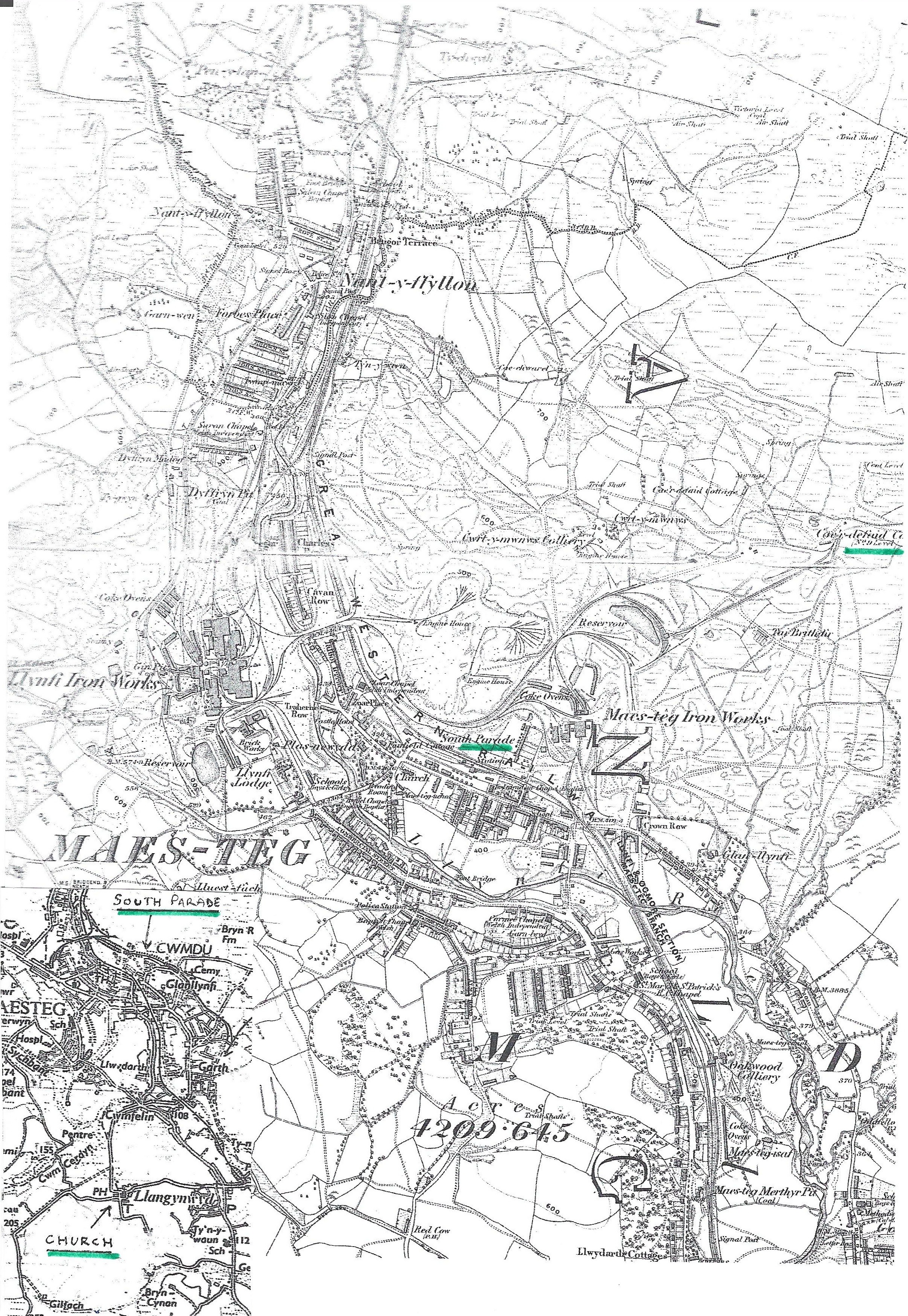
Ordnance Survey map of Maesteg in the Llynfi valley, annotated by the family: South Parade (home of Henry True) and the Caedefaid No. 9 Level, where he worked, are highlighted in green; an inset modern map marks South Parade at Cwmdu and the church at Llangynwyd where Henry and Ann True are buried.
Source
Cropped from a scanned page sent by Dan Griffiths in an email to Michael Currie on 4 October 2026 ("More Info Enjoy. Dan").
Dan Griffiths."More Info: True family photographs, Llangynwyd burial notes and Maesteg pictures."[record].2026-10-04.Email from Dan Griffiths to Michael Currie, 4 October 2026, with five scanned pages.Link.(Rights: unknown | Access: open| Fingerprint: 329c4d9151eeb7958ac06604376e1d87b225b43b8d51a7b2b2b33db3678b2f11)
File history
Click on a date/time to view the file as it appeared at that time.
| Date/Time | Thumbnail | Dimensions | User | Comment | |
|---|---|---|---|---|---|
| current | 18:28, 11 October 2026 | | 2,409 × 3,489 (4.02 MB) | Admin (talk | contribs) | True family pictures from Dan Griffiths, 4 Oct 2026 (cropped, rotated) |
You cannot overwrite this file.
File usage
The following page uses this file:
